Thursday, September 30, 2010

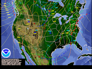
There is More Yet to Come

Most of New Jersey has been spared for most of Thursday however, we are still not of of the woods yet.
Parts of Southern Jersey had scattered showers and a few heavy down pours, nothing compared to deluge down South in the Carolinas (where they have had 15 inches plus of rain fall since Wednesday) leaving many residents believing that Jersey got lucky on this storm.

Strong low pressure from the Carolinas will move Northward and ride along the coast this evening through early Friday bringing with it heavy rain and strong gusting winds. Gusting winds have been on the rise throughout the day, and will continue to do so through the rest of the evening. Considering this, the National Weather Service continues to have the entire area under a wind advisory and high wind watches and warnings through the evening.
So far today, rainfall amounts have been quite impressive. Rainfall rates of 1-3 inches per hour have flooded areas from the Carolinas Northward, and more such is expected for Delaware, Pennsylvania, New Jersey, and portions of New York. The biggest concern here are streams flooding, leading into rivers flooding. Considering flood stages, and how much precipitation has fallen in total, most areas and rivers will continue to flood well into Friday evening possibly into the weekend.
Remember from last post: however much precipitation has fallen upstream, will flow and accumulate further downstream.
There was a tornado watch in effect for much of the day has been canceled, however in some of the stronger 'shower' cells, there RADAR has indicated there could be rotation within. Keep updated with the NWS or your local news for any rapidly changing (severe) weather.
East GOES Water Vapor Eastern U.S.: NHC/NOAA
Series of low pressure areas have been riding along a stationary front that is positioned along the East coast. Again, this 'swath' of moisture is from a tropical conveyor belt that is pumping a surge of tropical moisture into the Northeast. The first low passed just West of Jersey earlier today. The second low is/was still developing over the Carolinas this afternoon and will journey Northward and further East (compared to the last low that was further to the West). This slight shift to the East is associated with a dip in a cold jet from Canada. This area of low pressure will slog by and heavier rain will fall and create flooding. Along with the secondary moving though are the remnants of Nicole, which is also swept up in the tropical moisture. The reason for all of the flooding and the rain that has fallen (especially some areas more then others) is because these 'showers' are just following each other along the same track! Some areas in Delaware have seen as much as 10 inches of rain from a hour or two of a straight deluge!

As for the weather tonight. Rain, rain, and more rain! The heaviest rain will fall this evening over Maryland, Delaware, Pennsylvania, New Jersey, New York, and portions of New England. Thunderstorms are not likely however, it can not be ruled out.  Rain can fall 1-3 inches per hour. Power outages are possible due to wind gusts of 40 mph plus. Expect a pretty rough commute Friday morning. All should let up towards Friday afternoon.

Hey, at least this all isn't snow!

Wednesday, September 29, 2010

Update from Last Post

An hour after the last post was posted, the National Hurricane Center released a new update on Tropical Depression Sixteen. The system has been upgraded to Tropical Storm Nicole. Maximum sustained winds are 40 mph (as an fyi, the max winds to make a system a Tropical Storm is 39 mph - 73 mph, anything lower is a depression), with central pressure of 996 mb. The exact forecast projection is still uncertain. However, considering the tropical flow feeding from the Gulf, models are still forecasting the system to move along the Easter coast. The Tropical Storm Warnings for most of Florida have been lifted, but other watches and warnings are still in effect through Thursday evening. By the time the system move up to our area, it could be downgraded to a depression or lower.

Jersey could be spared the heaviest of the rain. Remember, most of the area is still in severe drought stage, the ground is very dry. One, the rain could come down heavy enough and not be able to absorb into the ground at a fast enough rate to compensate the amount of rain which would end up in potential flooding, and two, at the end of the event, there still wouldn't be enough rainfall to get us out of a drought. 
NCEP GFS Model Total Precipitation: NCEP/NWS/NOAA


This is a model image from the GFS, PCP 36, showing the total rainfall amount (that fell) by the time the system moves out by Friday: most of central Jersey is forecasted to have about 5 inches of rain, with locally heavier amounts. Note: there is a bit of a discrepancy between the models as far as how my precipitation and such should fall, the the GFS has the most through central Jersey. Below is the same time frame from the NAM model, where it has the swath of heavy rain further West of New Jersey.

NCEP NAM Total Precipitation: NCEP/NWS/NOAA


It is still a wait and see game. I do still believe we can and will see quite a bit of rain later this evening through Thursday. As for now, the forecast and such from the previous post will not change.

Don't be Fooled...

Don't be fooled by this mornings sunshine my friends, because more rain is still ahead. The National Weather Service has issued a Flood Watch (and possibly a Flood Warning a little later) along with Gale Warning and High Surf Warnings towards the coastal areas of New Jersey, and New York until Thursday evening. Are you ready for round two!?

Now, you must be asking; "Why all this wet weather all of the sudden?" This pattern that we have been in for the past few days has been extremely tropical. The culprit: this swath of clouds and tropical moisture that is feeding from the Gulf of Mexico. You can get a very good idea of this from looking at the image below. Pretty cool right? Who would think that the Gulf could be driving weather all thousands of miles up to Jersey?

NOAA GOES East Conus Sector: Infrared Channel
Take a look at the green area down by Cuba and off the Florida coast. This is Tropical Depression Sixteen. This tropical low will ride up along a stationary front that is draped over the Eastern coast. Now, don't underestimate the strength of merely a tropical depression. It can, and will drop a significant amount of rain, especially in a short amount of time. Remember hearing in the news just last week, of historical record breaking flooding in Minnesota? Up to ten (10) inches of rain fell in such a short amount of time from a tropical system.
There are Tropical Storm and Tropical Storm Wind Warnings from Florida up to Cape Hatteras, North Carolina and Flood Watches (at the moment) from Virginia to Massachusetts coast.

Projected Path of Tropical Depression Sixteen: NOAA
The calm weather will turn for the worse towards this afternoon...the weak high pressure will give way to the tropical low that will gain energy and strength as it heads North from Florida. Forecast models seem to depict deep tropical moisture and strong storm inflow. Streams and creeks will be the first to flood followed by larger rivers; we will be watching the Delaware River as the storm progresses. Depending on how much precipitation falls: rate and amount, will depend on how much cumulative rain we will see. As of now, however it can and probably will change, up to 4 inches generally, but locally heavier up to 7 inches plus and could be more further East...That is A LOT of rain! There is also a chance for embedded thunderstorms Wednesday through Thursday.

Physical Geography of New Jersey


Not only is the rain from the main event an issue, but as this storm moves off the coast, the residual runoff water is what poses the main threat. What ever rain fell upstream (i.e. further North) in the Kittatinny Mountain and Highland areas of New Jersey, will follow down the rivers and streams South, collect near Trenton, and make way to dump out in the Delaware Bay.  If you can remember, the flooding that almost always occurs in the Delaware near Trenton is from the runoff from the river up North.

The last weather threat will be the wind. Models are showing a lowering Jet (stream) entering the area early Thursday with winds of around 80 knots (around 70 mph) over Southern regions. Some local wind gusts could reach up to 40-50 knots. A high wind watch has been issued. Be advised of very strong and damaging winds.

With all that said, the Sun will yet again, creep in behind the clouds, as more tropical moisture moves back into the area. The rain arrives this evening, with the bulk of it most likely falling during the early morning hours through the work commute into early afternoon. Expect and be prepared for the worst when it comes to this kind of tricky tropical weather. The system is forecasted to let up towards the evening. Following the system is another pattern change Finally sunny skies that will stick around and temperatures finally giving us a taste of the Fall season. Daytime high temperatures Friday through the weekend will reach to the lower 70s, falling to the middle to lower 50s towards the evening.

Get ready to build an Ark!


Monday, September 27, 2010

Have an Umbrella Handy!

It is going to be quite uncomfortable for the next few days as our weather will be dreary, rainy, and wet. A frontal boundary still remains Southeast of NJ, but is forecasted to Northwest today (Monday). The models are showing this slow moving front (Quasi-stationary front: an area of high or low pressure that is nearly stationary) moving back towards the Northwest as well as a low level frontogenesis (the initial formation of a front or a frontal zone. Hence, genesis meaning: the creation of..).
Once these waves arrive closer and pass through our CWA, there looks to be some energy associated as well as some lifting air or overrunning (isentropic lift is the physical lifting of air in which it can be characterized by widespread stratiform clouds, precipitation, and may also include elevated convection in the form of embedded thunderstorms) (NWS), especially towards the Northwestern parts of the area where they could see some heavy rain and a thunderstorm can not be ruled out.


1200Z Mon 12/9 Courtesy from HPC/NCEP


The Storm Prediction Center (SPC) has placed our area under a slight risk for severe weather, especially towards this evening through Tuesday, due to the instability in the atmosphere and the shearing gusting winds moving in this evening, becoming stronger Tuesday, as well as if there is enough added moisture and warmer temps by this evening.  Winds are forecasted to become rather impressive this evening, especially aloft, but near the surface, near 10-15 mph Monday evening, becoming 15-20 mph with gusts up to 30 mph Tuesday. With the added wind gusting Tuesday, the chance for shear (variation in wind speed and/or direction over a short distance within the atmosphere. Shear usually refers to the vertical wind shear: change in wind with height) (NWS) increases as does the chance for convective or severe weather.

1200Z Tues 28/9 Courtesy from HPC/NCEP


For the most part, this week will consist of unsettled weather. Remember, even though it may be considered to be the Fall season, the weather goes through a few weeks of transition, if you will, where the weather patterns can usually be rather erratic before it finally settles into the season.
Considering this, temperatures will be all over the board ranging from blistering heat last week, humid and flirting with the 80s Tuesday, to middle to lower 70s towards the end of the week.

**Some of the weather models are leaning towards our first frost Sunday!** In the Suburbs, nighttime lows Saturday P.M.- Sunday A.M could be in the mid 40s, and in the higher elevations, temperatures could be as low as the upper 30s! Typically, the first frost occurs over the Northern states around the Autumnal Equinox, however, with our erratic transition, it has been delayed about a week or so.

Friday, September 24, 2010

Parting of the Waters

I was watching the news (Date Line or something) the other evening when a commercial headline teased a story on scientific proof on the Bible story of Moses and the parting Red Sea. I remember smiling when I heard this thinking back to my grade/middle school days. I attended a Catholic school then. I remember I would constantly get in trouble because my scientific mind was always questioning the nuns on the Bible teachings, especially when it came to the 'history' of the Earth and civilization...'how could Adam and Eve be the beginning of humans...what about (Darwin's theory of) evolution?' Then I would receive detention.
All that questioning made me chase after a degree in Earth Science to which my devout Catholic-Italian grandmother does not believe is true because I was learning things in college that should not be true, based on the Bible that is.


According to the Bible, in the Book of Exodus, it is told that Moses was leading Israelites in flight from Egypt when they arrived to the shore of the Red Sea where they were being pursued by the Egyptian army. At that point, it is said that "Moses stretched out his hand over the sea; and the Lord caused that sea to go back by a strong east wind all that night, and made the sea dry, and the waters were divided. And the children of Israel went into the midst of the sea upon the dry ground: and the waters were a wall unto them in the right hand, and on their left." Then later in the passage, it is told that once all Israelites passed through, Moses turned back, stretched over his hand and that wall of water returned back on the Egyptians by morning and Israel saw the Egyptians dead along the shore.

Recent study and computer models show that there actually is some plausible accounts of Earth science history with in the Bible. The study suggested of sustained winds within the coastal lagoon where the Mediterranean and the Nile met nearly 3,000 years ago. NCAR oceanographers wrote: under a steady blowing wind of 60mph plus, "the ocean model produces an area of exposed mud flats where the river mouth opens into the lake. These mud flats represent the area of crossing, and the crossing party would observe water to the right and left." This mud flat area would remain open for hours, long enough to allow passage through the ankle-deep mud, then the water would fill back in once the winds subsided. This is called a wind setdown. It is essentially the reverse of storm surge when steady strong winds cause water to dramatically rise in some areas, and falls in other areas.

Numerial Simulations of the Wind setdown

It is just intriguing to know that are Bible accounts of Earth's physical history dating back from 3,000 years ago. We can get a better understanding of Earth if we just connect the myth and the science. Considering the history of the Earth, technology has just scratched the surface when it comes to cracking this story.

It literally did not look like this... check out the link to the video to see the computer simulation of the Red Sea parting.

Saturday, September 18, 2010

Tornadoes in Jersey?

Thursday afternoon, severe storms riped through New Jersey and parts of New York with no remorse. Although storms were forested Thursday, the severity took most people off guard. I will admit, after working all morning and day Thursday, I only tuned into the RADAR just before a line of severe storms was knocking at my doorstep. I was actually quite eerie now thinking about it. My precious puppy Jasmine was outside barking non-stop. I looked out my window to see what in the world got her so upset to see the winds picking up and not hearing sound of birds or any other animal. My watch dog was warning me of the approaching storm! The way my dog, or any other animal for that matter, has that sense for bad things to come, especially the weather, it just so incredible! Checking in on the RADAR that moment after, it was like storms were blowing up all over the grid!
Now, I am quite afraid of lightning. Those of you who know me, know this very well. I'm not going to lie, I was pretty scared Thursday. Jasmine and I were huddled up tight on my bed because it was so loud!Continuous lightning all around, I'm pretty sure a house on my street was stuck by lightning, torrential wind swept downpours, and winds gusting upwards of 50mph. It was like mass chaos outside for about 15-20 minutes then all was calm. However, these storms did not completely die after they passed through Trenton, NJ. It just added more fuel as it worked it's way through parts of central Jersey. At approximately 5:15 P.M. Thursday a tornado warning was posted for a large swath of an area for portions of Middlesex and Ocean Counties (from as South of Jackson Twp all the way to the coast and North). The National Weather Service reported winds associated with a wet microburst that moved through the Southeastern corner of Perth Amboy in Middlesex County. This microburst produced a max. wind gust of appromimately 80 mph. Also within this line of storms, the Terminal DOPPLER RADAR associated with EWR airport indicated at that time, a rotating wall cloud and funnel cloud! However, the funnel cloud dissipated before the cloud reached the ground.


This image depicts what happens during a microburst. This definition from the NWS was the best well stated: 'a Microburst is a convective downdraft with an affected outflow area of less than 2 1/2 miles wide and peak wind gusts lasting less than 5 minutes. Microbursts may induce dangerous horizontal and vertical wind shears. Straight-line winds are generally any wind that is not associated with rotation'...the main difference from tornadic winds.

Many people are under the assumption that tornadoes can not happen in this tri-state area and that it is only a Midwestern weather phenomena. Let me tell you, TORNADOES CAN OCCUR ANYWHERE, as long as the proper dynamics are in place. Not only was there a NWS reported Microburst in NJ Thursday, but at appromimately 6:05 P.M. an EF1 Tornado touched down 2 miles Southwest of Wodruff in Ocean County, NJ. Thankfully there were no reported injuries, however there was quite a lot of damage with in the 2 mile path from this tornado that has maximum winds of 90 mph!

How can a tornado form? Well, there are three 'key' ingredients for creating this most violent kind of storm.
1.) moisture in the lower levels of the atmosphere
2.) unstable air
3.) lifting force (or heating air from the ground)

On Thursday, a warm front pushed through not only making temperatures warmer (#3) but adding more moisture to the air (#1); it did feel a bit more humid as the day progressed...Then, towards the late afternoon a trailing cold front worked its way in creating more unstable air (#2), a lot more moisture, and significantly cooler temperatures prevailing. Now, on a hot and humid day, which was a moderate the case Thursday, the moist air will rise until it reaches dry and cool air, condense and forms a cloud. The 'unstable' air so-to-speak feeds (the cloud grows higher in the atmos.) the cloud and creates a thunderstorm. The most severe of storms form when low level, moist, warm air from the South meets cooler air blowing in from the North or West (the cold front was moving in from the Southwest, while the center of the low was to our North filtering in cooler air from the Northwest). More energy can be added to a storm when drier winds are blowing from the southwest and can add to the velocity of the air that is rising (aka the updraft).


Tornadoes form on the inside edge between the updraft and the descending air which causes rotation. Since a tornado is a updraft, air is sucked up into the already rising air which is what creates the damaging tornado vortex. It is just simply the rising and sinking of air plus shear and an energy source that can create such dangerous storms.

Remember, when the skies turn dark, and you hear the slightest rumble of thunder, seek shelter immediately. Never try to out run Mother Nature, you will never win.

Wednesday, September 15, 2010

The Atlantic Continues to be Active

Courtesy of NASA: Incredible image of Igor from space


Hurricanes Igor and Julia continue to stir up the Atlantic, strengthening and weakening but large storms never the less.  As of the latest hurricane update from early this morning, Igor is weakening but still remains a strong storm. Igor is a Category 4 hurricane with current maximum sustained winds of 145mph with a maximum central pressure of (a beautifully low) 935 mb, 27.61 inches. The storm is moving slowly (which will allow for the potential strengthen of the storm) West-Northwestward at around 9.0 mph (NOAA) with so far a general forecast motion more Northwestward within the next 48 hours. 

Courtesy from NOAA: Forecasted Track of Igor


Now, what does this mean for us? It is still to early to tell. Forecasters can have a general idea of the storm track though observing the weather models, but until they are come in to some kind of agreement, it is difficult  to determine the exact path until about 48-24 hours out; even then, it could change.
As of now, the forecasted track has Igor riding far enough away from the Eastern seaboard. However Bermuda may not be so lucky. There is a chance they may see Igor make landfall, but not as a Category 4 hurricane. By this weekend, Igor should weaken substantially. 


Julia is the other storm reeking havoc in the Atlantic. Right behind Igor, there spins Julia, also a Category 4 storm. As of this morning, Julia has strengthened and could continue to strengthen over the next 48 hours. Currently she is approximately 500 miles West of the Cape Verde Islands with maximum sustained winds of 135 mph with a central pressure of 950 mb, 28.05 inches.  Julia is moving toward the Northwest at about 10mph with a forecasted turn to the West-Northwest increasing in speed in the next 36-48 hours (NOAA). With both of these cyclones, there is no immediate hazards to land, because both are still far enough away at sea. The only exception is Igor will turn up the seas creating high swells near Puerto Rico will continue to create rough seas along the Eastern seaboard though the rest of the week into the weekend. 
Courtesy from NOAA: Forecasted track of Julia

Saturday, September 11, 2010

Desperately Needing Some of that Rain NOW!

It has been just about 3 weeks now since we have seen any kind of measurable rain! The EPA the other day announced that we (the Tri-State) are in a drought...umm, HELLO? I've been saying that a week after we haven't had rain. Oh, that's right, the week before the consecutive heat waves we saw.  Couldn't EPA report a drought watch or a precautionary warning for a drought before we even reached that stage? We have seen heat wave after heat wave, still no rain, and people everywhere are using up our water sources to save plants and lawns from burning...Let's think about this people...

Latest U.S. Drought Assessment: http://www.cpc.ncep.noaa.gov

NOAA's State of Climate has just released a report stating that this Summer was the fourth warmest Summer in U.S. records. According to the report, the average temperature for the United States in August was 75.0 degrees F, which is about 2 degrees F about the long-term (1901-2000) average. July's average precipitation was 2.41 inches, which is 0.19 inch below the 1901-2001 average.
As we all know, it has been hotter then you know... in the North East, many of the Tri- State major cities with Central Park, New York City, Trenton, New Jersey, and Philadelphia, Pennsylvania breaking record high temperatures this Summer. The main culprit for such hot weather was a pretty consistent High Pressure setup that dominated the weather pattern, especially this past month. According to the State of Climate report, The Northeast region of the U.S. "experienced its warmest January-August period with an average temperature more than 3.4 degrees F above the long-term average. Maine, New Hampshire, Vermont, Rhode Island, Connecticut, and New Jersey each had their warmest year-to-date period and all of the Northeastern states ranked in the top 10% of warmest periods on record."
With the consistent heat waves, it's no wonder the major cities did not have a brown out like last Summer. I must say though, the electric companies did do a terrific job in preventing this. I do remember losing my power just for a few hours due to a heat related incident, but considering it could have been a lot worse, this was not all to bad.
Image Courtesy from NOAA
As far as precipitation goes, throughout the contiguous U.S. rainfall was highly variable which is the typical pattern for late summer. The overall precipitation average was below normal with 11 states experiencing below normal precipitation (including New Jersey and Pennsylvania), and another 11 states experiencing above normal precipitation with the Northern Midwest being the wettest.

Just a note: I looked at the camera on my phone to try to upload Hurricane Earl photos to find out that the phone never came with a phone-PC adaptor...major bummer considering I did get some great beach shots. After this experience I now know to keep a fully charged (with an actual battery this time) camera always on me at all times.

Near term weather:
Increasing clouds this evening with a chance of showers (Lord knows how much we really need here!).  Becoming more humid though the evening. If the air moistens up enough we will see rain, most likely Sunday and throughout the day. Otherwise it will remain mostly cloudy much until early Monday. Thunderstorm probability is low.

There is a beautiful triple-point located over Ohio (at the time of the image)..Oh, how synoptic met. haunts me today...This 'point' will move towards the South of us and remain South which will, unfortunately for us, keep any kind of significant precipitation and convection further Southeast of the I95 corridor areas. Note: the overall precipitation values are highest where the potential for convection is greatest, which is not going to be by central New Jersey this time around. The next chance at a shot of rain from this system will be late Sunday into Monday as a trailing cold front from the Northwest moves through that looks to carry a bit more moisture, even then fingers are still crossed to see some rain. Temperatures will remain in the mid 70s falling to the upper 50s, to lower 60s in towards the evening.

Keep an umbrella handy!

~ V.S.


Wednesday, September 8, 2010

Cool Temperatures Ahead

As a cold front passes through the area this morning, much cooler temperatures will follow.
There is a chance of showers and storms with enough instability and convection, however not much moisture associated with, through early Wednesday as this strong cold front moves through. Temperatures prior to the fropa could get up to the humid upper 80s and after breezy and mostly clear mid 50s.
Thursday into Friday will be a bit windy associated with a 'strong cyclonically curved 300 mb jet that is over the Great Lakes into New England' (NWS)... Oh how I miss Zois's Synoptic classes and drawing these closed lows on maps to the point that all the contour lines morphed into one...
I must say, the maps today look to show quite a beautiful synoptic setup.
Generally with this setup, the surface front will allow enough CAA (cold air advection) and a (drier) downsloping flow into the area which will allow some gusting winds and an explanation for one of the reasons, along with a rain deprived Earth for about the past two weeks, is why the National Weather Service has issued a Red Flag Warning through Thursday. A Red Flag Warning is issued when the relative humidity (the amount of water vapor in the air) is low and falling dewpoint (the temperature given to a parcel of 'humid' air must be cooled at a constant pressure for the water to be condensed: think a cold glass of water left outside on a hot day...the condensed water is know as the dew, and the dewpoint is the saturation point) values below 30%, along with gusting winds make up for  dry enough air to support fires.

Temperatures this evening will fall to a chilling mid50s with some suburbs falling to the lower 50s this evening. As for Wednesday: Sunny and 75: My ALL time favorite (sunny) weather. The winds will still be gusting about 15-20mph so it will feel a bit cooler but beautiful nevertheless.

~V.S.


Sunday, September 5, 2010

Berrrr, Chilly evenings?

Such a BEAUTIFUL day this Sunday! Sunny skies, comfortable temperatures, and a light breeze equals a perfect day to enjoy the outdoors. However, not so much for playing tennis which I attempted, but did not succeed because the wind kept blowing the ball around (either that or I am in denial that I am actually awful...I think I would rather blame the wind).

High pressure will slowly move off the coast but will still remain in control for early week. Days like yesterday and today; clear, warm, and sunny skies and clear skies in the evening, will make for cool nighttime temperatures. I spoke to a few people today who said they had to close their windows last night because it was TOO cool.
What? Too cool for September? Although this weekend marks the 'unofficial end of summer,' it is still the Summer season.
These cool temperatures are caused by a little something called....Radiational Cooling.

Radiational Cooling is the 'cooling' of the Earth's surface. During the daylight hours, the Earth is heated. At night, the Earth suffers an overall heat loss to space due to terrestrial (the ground cooling) cool; one would think the opposite of cooling considering Earth is giving off its heat. This cooling process is more pronounced when there are clear skies (NWS).

Most of New Jersey had low temperatures last night (technically this morning before sunrise) in the middle 50s. Central Jersey was a cool 55degreesF with a gusting NW wind that made it feel a lot cooler.
Areas in higher elevations such as Mount Pocono in PA had a low temperature last night of 48degreesF with high temperatures Sunday only getting up to 65degreesF with forecasted lows in the LOWER 40s!

Tonight will be anther cool night. Keep a jacket handy when when out and about at your holiday festivities; lows in the middle to upper 50s. With increasing humidity through the evening and Monday, patch fog can not be ruled out in the morning hours Monday.
Increasing humidity Monday; more moisture in the air equals (a few) more clouds in the atmosphere; expect mostly sunny skies Monday through Tuesday.

Temperatures will remain in the middle 80s Monday but will soon get warm Tuesday and Wednesday which it will be flirting with the 90s, again.

Beautiful image over cloud deck at 25,000ft 

~ V.S.

Saturday, September 4, 2010

The Calm After the Storm

Beautiful sunny skies this Saturday left everyone scratching their heads wondering how there was a hurricane just off our Jersey coast just 12 hours ago.
Hurricane Earl has come and left sparing the New Jersey Tri-State area the worst. Earl has significantly been downgraded to a Tropical Storm and is still continuing its track NNE.  Aside from periodic showers, a very tropical feel in the air, and some gusting winds, most of the New Jersey area did not feel much in wake of Earl.
I will tell you this; I braved a trip to Belmar, NJ and I sure was not disappointed! Aside from both of my cameras not cooperating and not being able to take proper pictures of the event ( I was however, able to capture some form my cell phone which will be posted shortly),  the trip was ever so exciting! We went at low tide and the waves were traveling by the shoreline fairly high up; I can only imagine how it would have been during high tide at the time Earl was the closest. The waves were crashing over the jetty at Manasquan Inlet higher then I have ever seen, the water smelled so aweful, and there was this (creepy) salt foam ( kind of like the perfect cappuccino foam that you were get a Starbucks) all over the shoreline that I swore was going to fly in my up and hit me in the face...thank goodness it didn't.
All in all, beautiful!
The aftermath of Earl were beach erosion and down trees; which was originally expected. I do believe that if the cold front that was pushing though at the time was so there, and Earl tracked a bit further West, the story would have been a lot different. We were also blessed to be on the Western side of Earl, which saved us the strongest winds and storm surge (the Eastern side of the storm would cause all of such).
Hurricane season is not over yet my friends, so we still must keep a watchful eye.

Sunny and windy skies today made for a beautiful transition from the weather we have seen over the past week or so. High temperatures in central Jersey got up to near 80, but with the cool W-NW gusting winds, it kept the air quite refreshing...however, no so much so for my fellow allergy suffers ( you all know what I mean here)!
Light winds this evening could allow for radational cooling this evening allowing temperatures in some places significantly cool, otherwise clear skies and temperatures in the mid to lower 50s.

Sunny skies with a light to moderate gradient wind in the morning, but all should die off towards the afternoon. Temperatures again will be comfortable in the upper 70s.

Enjoy this beautiful weather!

~V.S.

Friday, September 3, 2010

Earl Arrives and Calming Weather After the Storm

Image courtesy from: http://www.rap.ucar.edu/weather/


Category 1 Hurricane Earl is just on our doorstep moving NNE sparing Delaware, New Jersey, New York, and portions of Long Island the wrath of its strength.
Although a Category 1, Earl is still a fairly large hurricane packing winds 85mph plus with central pressure of 961mb and slowly rising. Water temperatures are not quite as warm as they are towards the Southern Atlantic, and Earl is tapping into shearing drier air that is slowly beginning to colapse the strength of Earl.
Forecst tracks are still confident to keeping Earl well East off the areas coastal with the exception of far Eastern parts of Long Island  and coastal Massachusetts being brushed with the storm later this evening.
The National Hurricane Center is still keeping the Tropical Storm Warnings and Hurricane Watches posted until Earl passes through this evening.
Tropical Storm force winds, squall-like rain, and very rough surf will be the main concern through this afternoon in coastal regions. The rain and wind will decrease moving more towards inland.

As Earl pushes away, the clouds and rain will exit as well until a cold front moves its way in the area from the West, that will give us a much needed reprieve from the heat and humidity that we have seen. An upper level trough will develop to deepen this weekend over the area; which was our saving grace for Earl not making landfall on New Jersey and Long Island (although we are due my friends...) as high pressure sets shop over the region that will keep the weather mild, sunny, and dry. Saturday expect a very breezy day, especially by the coastal areas, with the gradient between Earl exiting and a new weather trasition entering the region. Wind gusts could reach up to 25-30mph.
As for near term holiday weather concerns, expect sunny skies with clouds clearing early Saturday and comfortable temperatures in the lower 80s falling to cooler lower to middle 50s in the eveing. Much of the same will hold for Sunday into Labor Day Monday.

Thursday, September 2, 2010

GOES Eastern US Sector Infrared Image

ECI8.JPG.jpg
.
Beautiful image of Category 3 Hurricane Earl and Tropical Storm Fiona in the Atlantic Ocean
GOES IR Data, NOAA

Hurricane Warnings and Watches, Tropical Storm Warnings


Hurricane Warnings and Watches, Tropical Storm Warnings have been posted as the Eastern seaboard awaits for Earl's visit. Earl will bring not only strong winds and potentially heavy rain but the main threat is dangerous Rip Currents along the East Coast as this Category 4 (downgraded to a Category 3 or 2 Hurricane as it rides up the coast) rips apart the Atlantic. 

Rough surf has been a widely major issue along New Jersey beaches as Hurricane Danielle moved past sparing the East Coast of significant damage.


Earl on the other hand, is a little too close for comfort. With the Delaware, New Jersey, and New York beaches in pretty bad shape from this past Winter's fury, sand and dune erosion from storms past has set up for potential high risk for significant storm surge damage. 


As of the latest updates on Hurricane Earl: Tropical Storm Warnings have been posted for the entire coastal DE/NJ/NY/LI and portioned inland areas of New Jersey Saturday. Storm tracks keep Earl well off shore however effects will be felt. The major affects will be strong winds and potential heavy rain. 


Category 4 Earl is expected to weaken as is passes Cape Hatteras, NC and moves its way towards the North East into cooler water and drier air. A Category 3 or 2 Hurricane still is not something to take lightly however. 

Note: Hurricane force winds ( for a Category 3 or 2 Hurricane 96mph-139mph) can be felt up to 75 miles from the center of the hurricane; the eye. 

Tropical Storm force winds 40mph-74mph can be felt up to 200 miles from the eye of the storm.


Take precautionary preparedness actions and keep updated on new warnings/watches! As for near term weather...sunny skies, very hot, and becoming more humid. Temperatures will be in the mid 90s, with heat indices in the upper 90s (some urban areas near 100). Increasing clouds this evening with temperatures falling to the mid 60s, will lead to overcast skies and impacts from Earl towards Friday afternoon. 


~ V.S.